
Map Macomb County Neighbors By Block
A block search in Macomb County has several layers. GIS shows the land around an address. The assessment record can show an owner or taxpayer for a parcel. A plat identifies the subdivision and lot pattern. Library material can add an older address entry. Association pages offer public organizational contacts, not household rosters. Keeping these layers separate makes a neighbor search more accurate and less intrusive.
| Block source | What it reveals near an address | How to reach it |
|---|---|---|
| GIS selected parcels | Adjacent tax IDs, property addresses, community, legal descriptions, and parcel geometry | Free Macomb County map, Identify, pan, or Buffer tools |
| BS&A address search | Owner or taxpayer, mailing and situs addresses, and published tax or property details | Public municipal data, with detail varying by assessor |
| Qualified Voter File | Authorized public voter fields and geographic codes, subject to redactions | Formal Michigan Department of State request |
| HOA contact directory | Association officer or contact route, not a list of residents | Macomb Township directory and contact form |
| Plat and subdivision records | Lot and block boundaries plus the subdivision name | GIS, Register of Deeds, library, or Archives |
| Library reverse directory | Historical address-to-name or business entries for a specific year | Mount Clemens Public Library index, volume, or request |
Macomb County neighbors may be visible in one layer but absent from another. A land record identifies a relationship to a parcel. A directory entry is dated. An association listing identifies an organization’s public contact. None should be stretched into a full account of who is in every nearby home.
Macomb County Neighbors Need Unit Context
The county GIS has an All Known Address search that queries the E911 address database. It can recognize individual apartment, condominium, mobile-home, and property-name locations that sit inside a parent tax parcel. The user guide advises omitting suffixes such as RD, DR, AVE, BLVD, and CT when a result fails, and the Community field can narrow a common street name.
This is a practical Macomb County neighbors tip. One parcel may return several unit addresses, while its assessment record lists one owner or taxpayer. Record the unit label and parent parcel together. Do not multiply an ownership field into a list of people or assume that a known unit address reveals every person connected with it.
Note: The E911 layer describes known address points, while a tax parcel describes land and its assessment relationship.
Macomb County Neighbors Association Contacts
Macomb Township provides an unusually direct public HOA route. Its HOA Resources page says the township is establishing an HOA contact directory, invites associations to submit a Contact Directory Form, and states that the township does not enforce specific HOA bylaws. The resource directory can be searched by category, name, or first letter. Its observed listings included Addison Crossing at Hartford, Averhill Condominiums, Beacon Square, Buckingham Village I and II, Carleton Place, Chelsea Park, Clearstone, and Cobblestone Ridge I.
The Macomb Township HOA Resources page describes the public directory pathway and its limits.
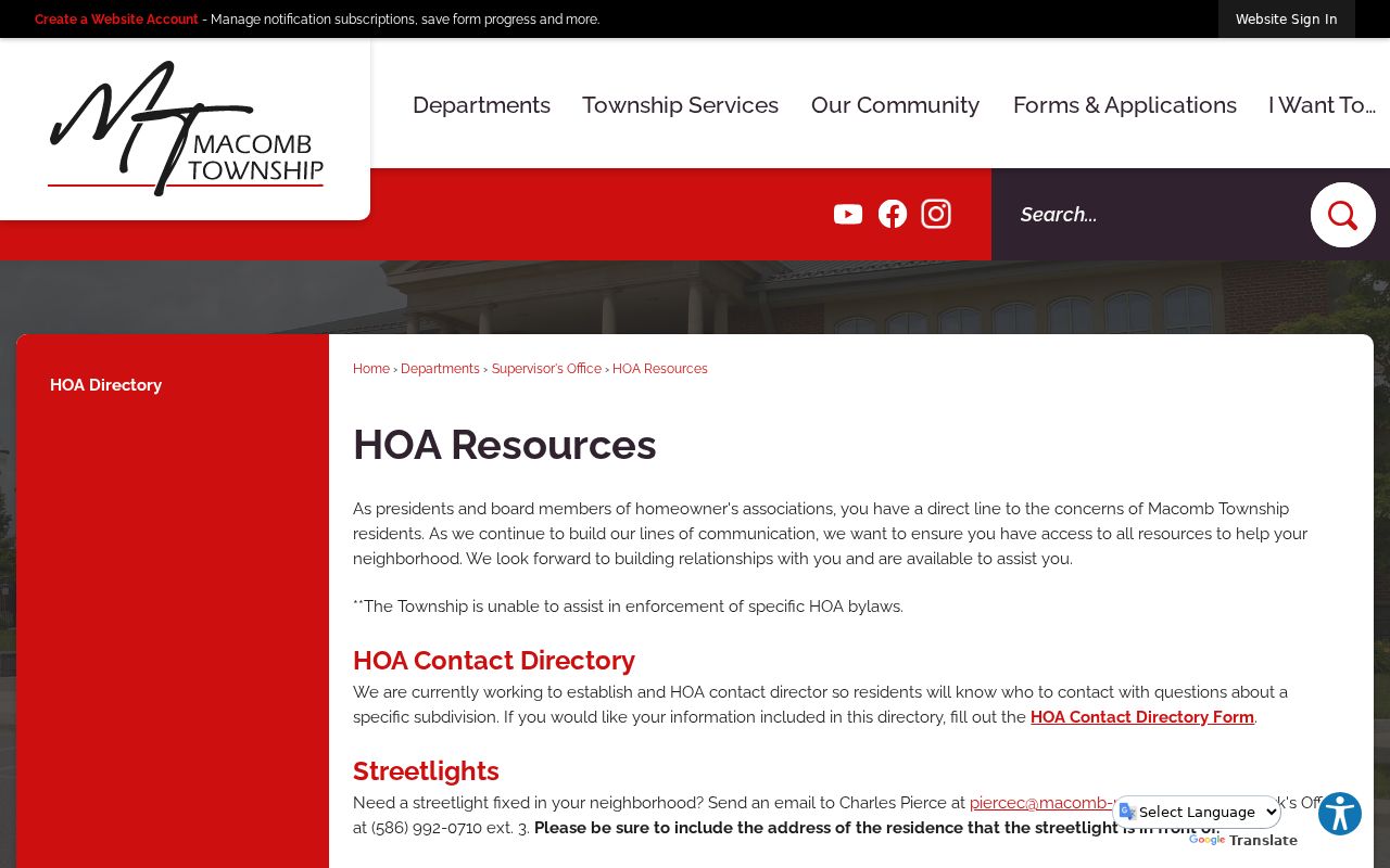
Use a listing to reach the association through its published contact channel. The directory can show officers, an association address, phone, website, or social-media page, but it is not evidence that every parcel nearby belongs to that association.
| Community contact route | Useful purpose | Boundary |
|---|---|---|
| Macomb Township HOA contact directory | Find a public officer or association route for a listed community | It does not publish a resident roster or enforce private bylaws |
| Macomb County Heritage Alliance | Locate historical and genealogical organizations, including the Macomb County Historical Society and Ray Township Historical Society | Member groups are historical resources, not a current block list |
| Mount Clemens Public Library local indexes | Check church, cemetery, funeral, military, newspaper, yearbook, and directory clues | Each index has its own coverage and access conditions |
Macomb County Neighbor Tools Compared
Official records and commercial neighbor-lookup categories serve different purposes. The official route identifies a custodian, a parcel, a date, and a way to correct an error. Commercial reports often combine public records, marketing files, and uncertain matches into a paid result. A match can be stale or can merge different people, so it should not be treated as an official block roll.
| Route | Strongest use | Important limit |
|---|---|---|
| GIS and assessment records | Confirm a parcel, map position, tax ID, and recorded owner or taxpayer details | Does not establish every person using the address |
| Register, plat, and library sources | Trace legal land context or a dated historical address entry | Coverage, indexing, and name forms vary by source |
| Commercial neighbor tools | Provide a lead that may need independent checking | May be stale, combine people, or lack the custodian’s correction route |
The Macomb Township HOA contact directory shows the kind of organization-level information a public community listing can offer.
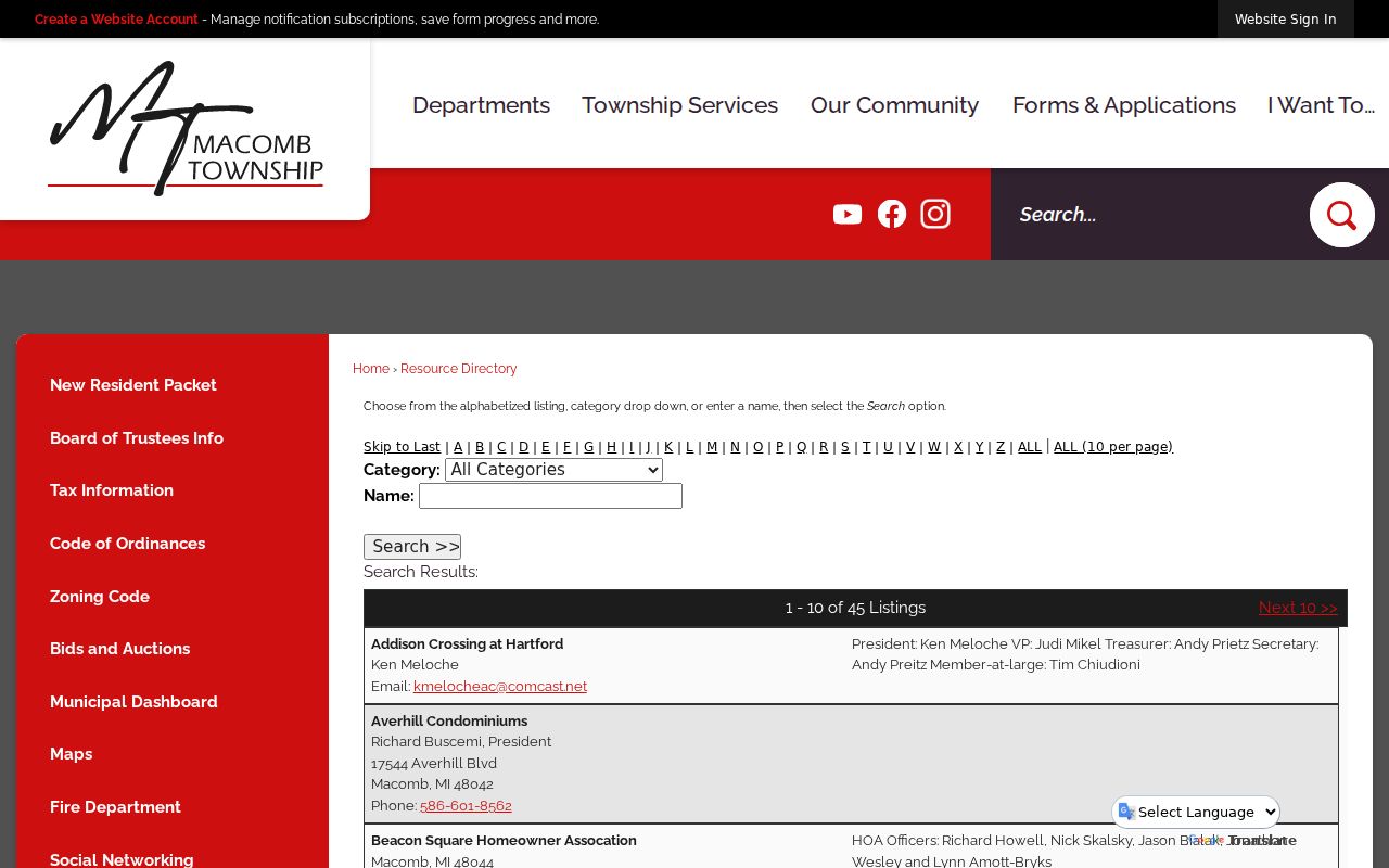
Its value is the public contact route. Treat association information, government parcel information, and dated library material as separate evidence rather than combining them into a private household profile.
Macomb County Neighbor Parcel Flow
Use the county’s Comprehensive Mapping Service to make the block map first. Search the target address, select its polygon, and record the tax ID, property address, community, and legal description in the Selected Tax Parcels panel. Then use Identify on each next polygon or pan at the same map scale. A Buffer tool can draw a radius in feet when a distance is more helpful than immediate visual adjacency.
- Locate the address and preserve the target parcel’s tax ID, legal description, and community.
- Use the selected-parcel panel, pan, or a buffer to identify surrounding tax parcels without assuming that all are part of one subdivision.
- Open the linked assessment record for each relevant parcel and compare owner or taxpayer, mailing address, and situs address.
- Read the plat or subdivision name when the block layout needs explanation.
- Switch to the Macomb County street directory only when the question expands from the immediate block to a full named-street record chain.
A map buffer is geometric, not a legal definition of a neighbor. Corner lots, cross-street frontage, and irregular parcels are reasons to preserve the map date and parcel identifiers with the result.
Macomb County Neighbors, Not Voter Rosters
The Michigan Voter Information Center is not a public block roster. Its name search requires first name, last name, birth month, birth year, and ZIP, or an alternate license-based identity route. It is designed to help a voter review registration, polling, ballot, and absentee information. It should not be used to imply that every person on a block can be viewed through a street search.
A formal Qualified Voter File request can use one selected geography and may include public fields such as complete name, residence or mailing address when available, year of birth, registration date, voter status, voter ID, and requested history. MCL 168.509gg withholds license or ID numbers, full birth-date details, telephone and email fields, signatures, and Social Security digits. Address Confidentiality Program and other protected records require special handling.
This is a common Macomb County neighbors myth: a map does not create a voter list. Use the Michigan Voter Information Center for its stated individual-confirmation purpose, or use the documented Department of State request route and its redaction rules.
Macomb County Neighbors Need Plat Context
Subdivision plats name the block before most later records name a person. They connect a GIS tax ID to a lot, block, subdivision, and older street layout. That matters in a county with dense southern subdivisions, unit-level E911 addresses, and rural northern township plats. A nearby parcel may be part of a different subdivision, sit on a cross street, or use a different local custodian.
Start from the legal description returned by GIS, then compare the Register of Deeds, plat books, library material, or Archives holdings. The Mount Clemens Public Library directory index is useful for an older block question, but its 1896–1966 run must be matched to the actual year and volume. A negative result should be reported as a gap in the searched run, not as proof that no person was there.
Note: Keep the plat name, parcel ID, map date, and source date together so the block description can be repeated and checked later.
Macomb County Neighbor Lookup Limits
A neighbor lookup has firm privacy boundaries. Private utility, delivery, and motor-vehicle address data are not public block-search channels. Other household members may not appear in a land, association, or directory record. Protected voter records, sealed court material, and restricted vital or adoption records are also outside an ordinary search. Michigan’s Address Confidentiality Program gives eligible people at risk a designated address and mail-forwarding protection.
Macomb County neighbors are best understood through public land geography, historical sources, and voluntary organization contact pages. When an official record is wrong, ask its custodian how to correct it. Keep only the fields needed to verify a parcel or source, not a private dossier about nearby people.
Lawful use. Use Macomb County neighbor records for lawful personal research, family history, community contact, property questions, or civic awareness. Repeated unwanted contact, intimidation, or surveillance is not authorized by a public record and can violate Michigan’s stalking law, MCL 750.411h.